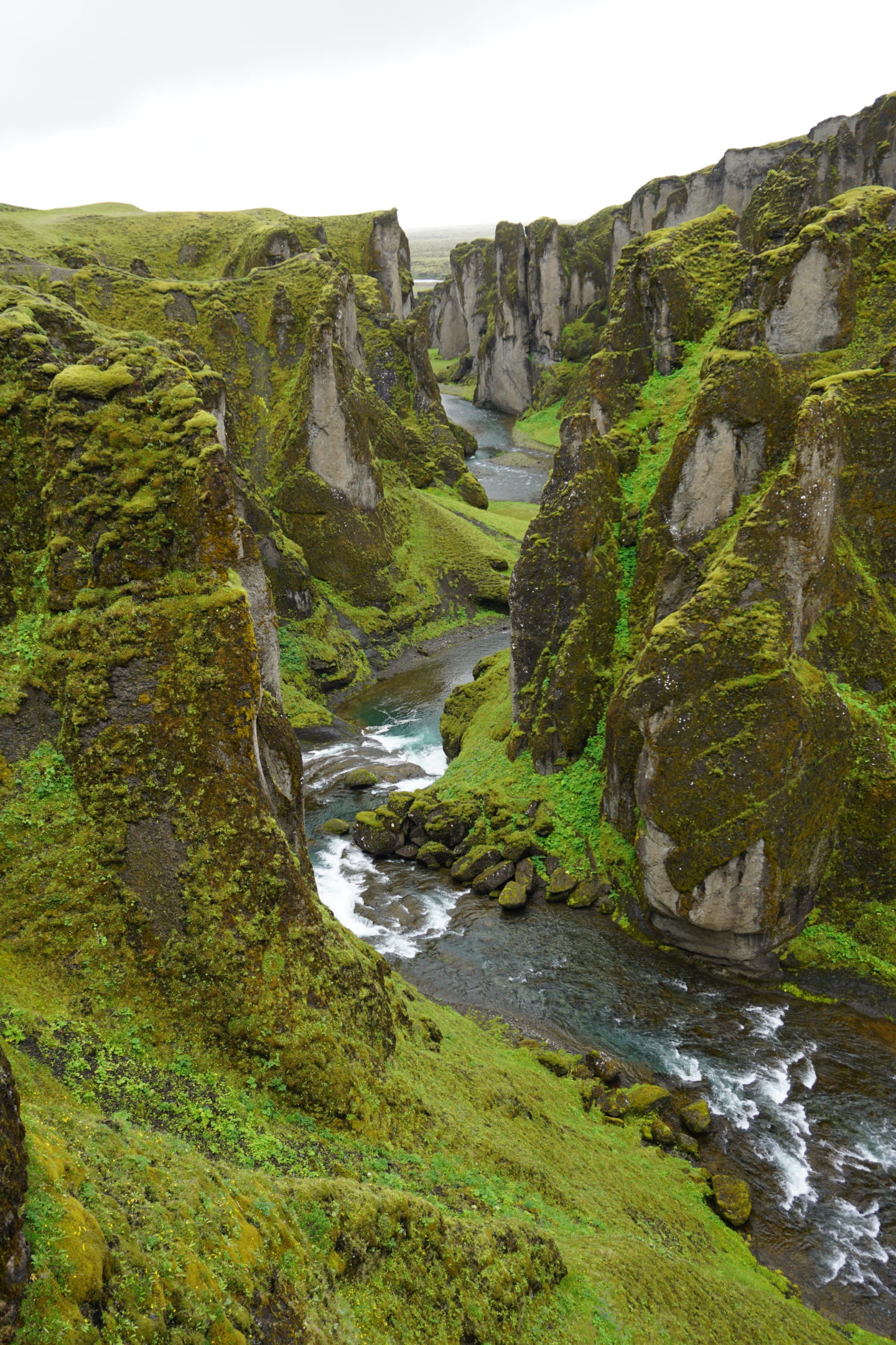
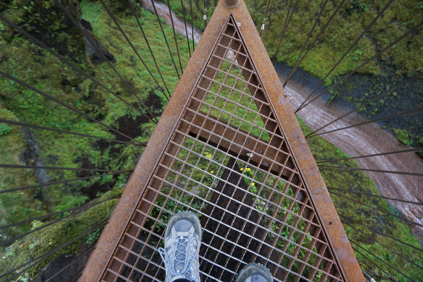
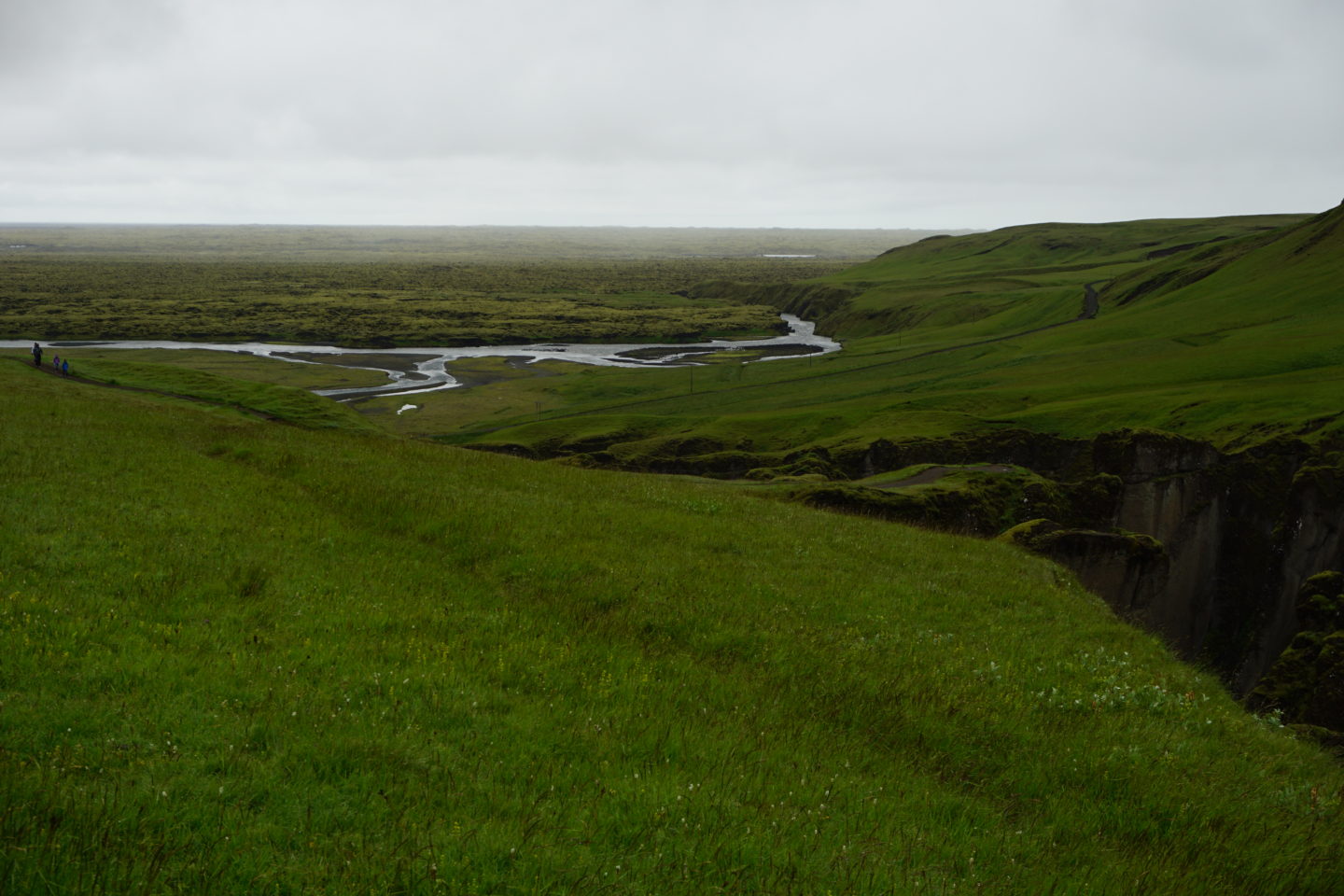
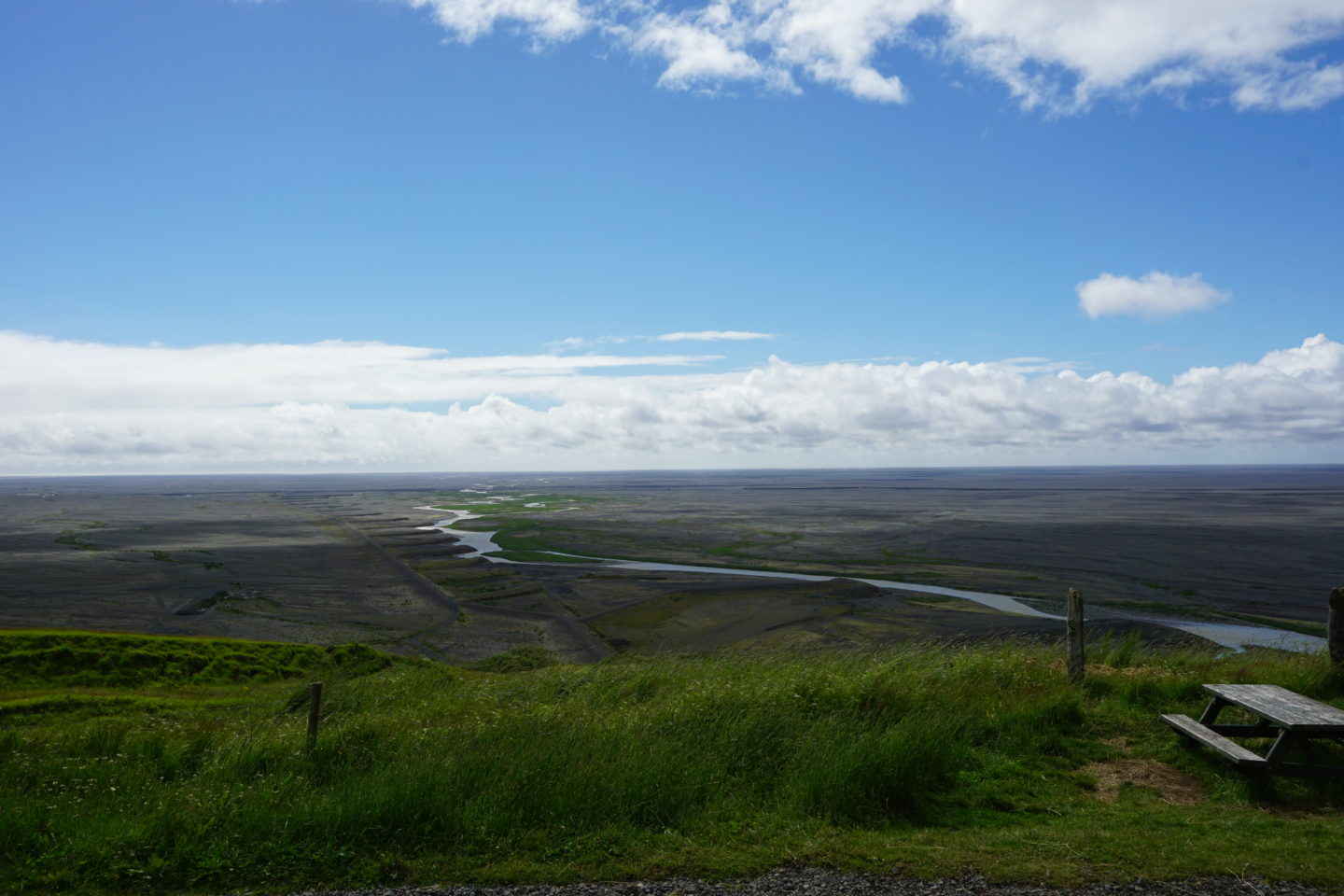
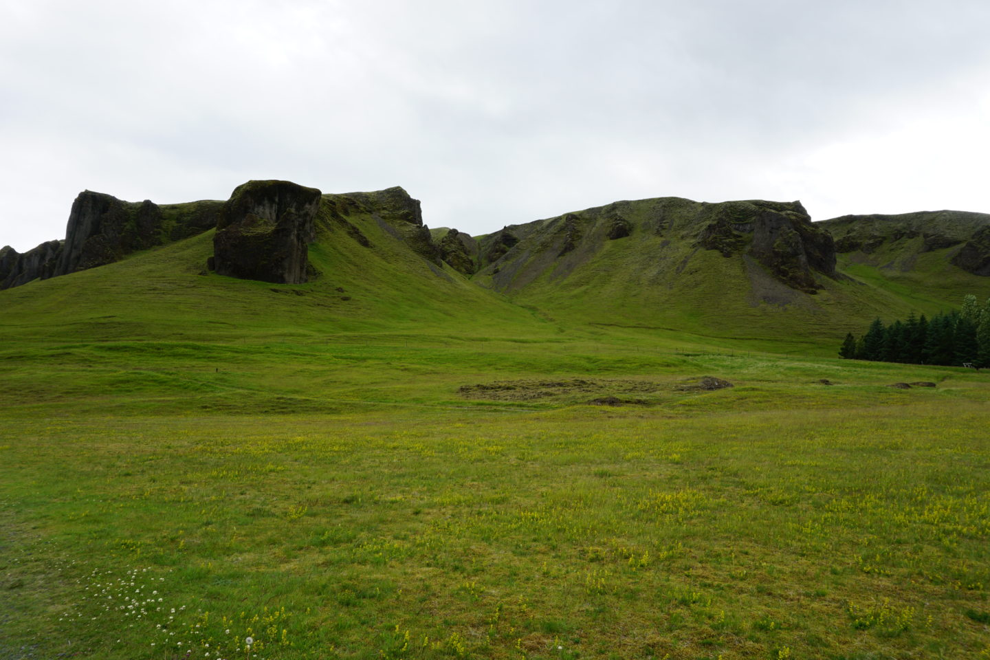
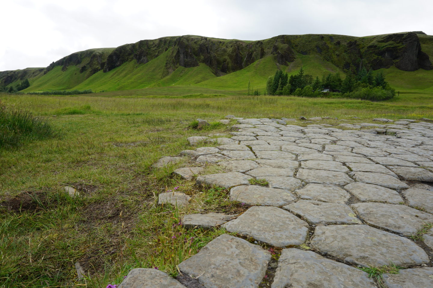
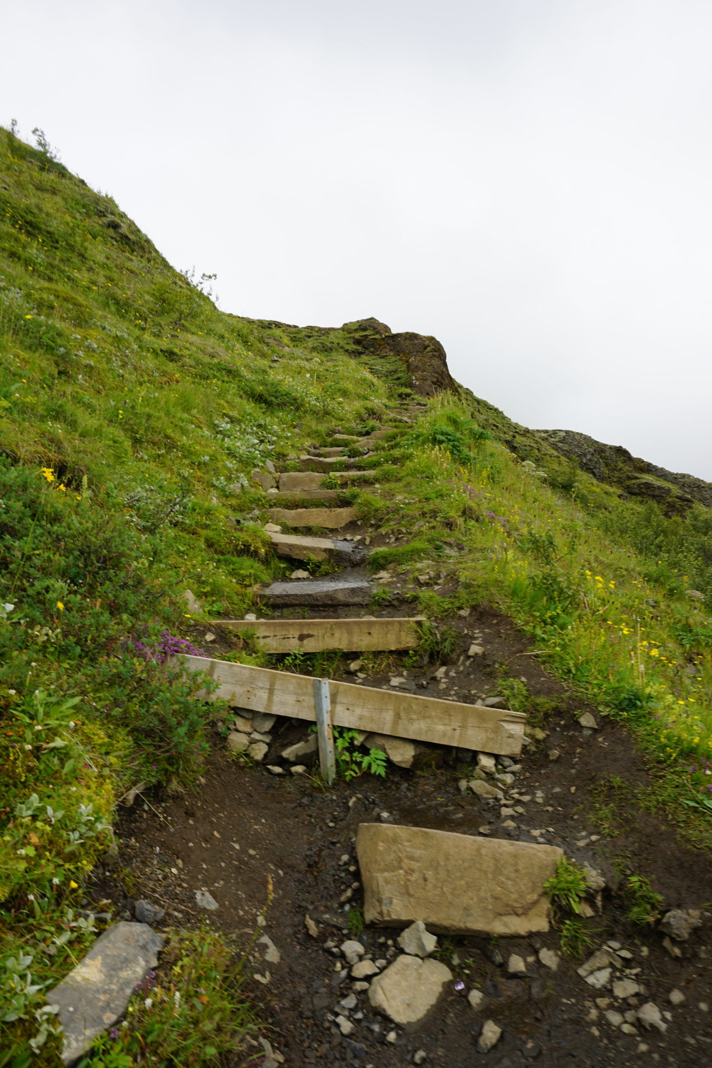
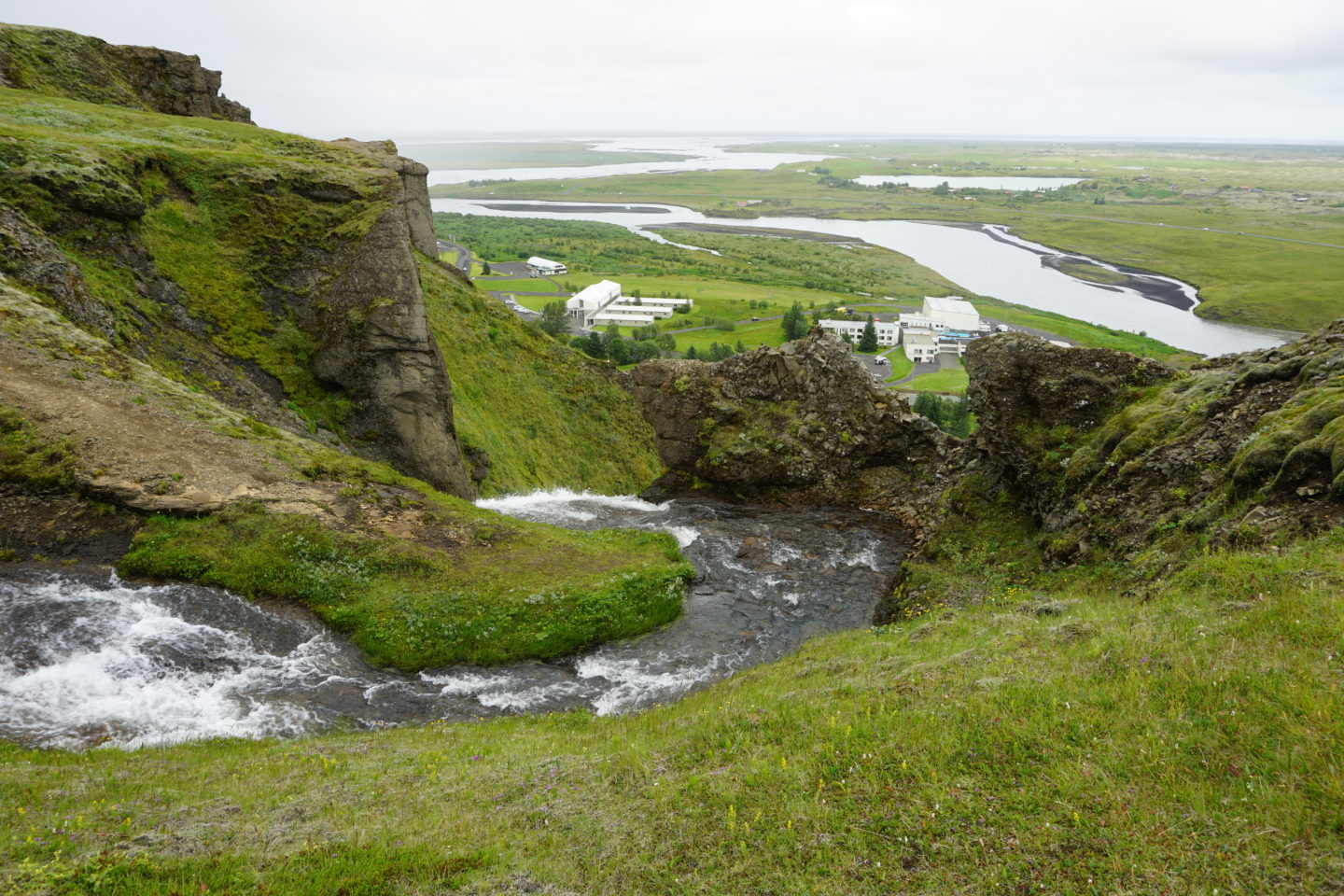
On my third full day in Iceland, I started off at Fjaðrárgljúfur, a 100m deep canyon that stretches for 2km. It was only 2km behind the guesthouse I stayed at the night before, which is kind of one of those things in Iceland I’ve found – there are always breathtaking places just hidden around the corner that you might miss if you don’t know they’re there. You can even see this in the third photo below – looking at the location of the canyon, you might even miss it! This canyon is thought to have been formed at the end of the last Ice Age and is around 9000 years old. When I was here, I kept thinking of my dad. He was terrified of heights, and there are so many places I’ve been in Iceland that he would’ve just refused to go and maybe even tried to stop me from going! On a visit to the (at the time) world’s highest suspension bridge in Colorado, he wouldn’t go across because you could see through the bridge platform to the gorge below – something most people wanted to be able to see. The lookout platform below is a prime example of this kind of thing. I honestly was getting a bit light-headed when I looked straight down and I don’t even really have an issue with heights!
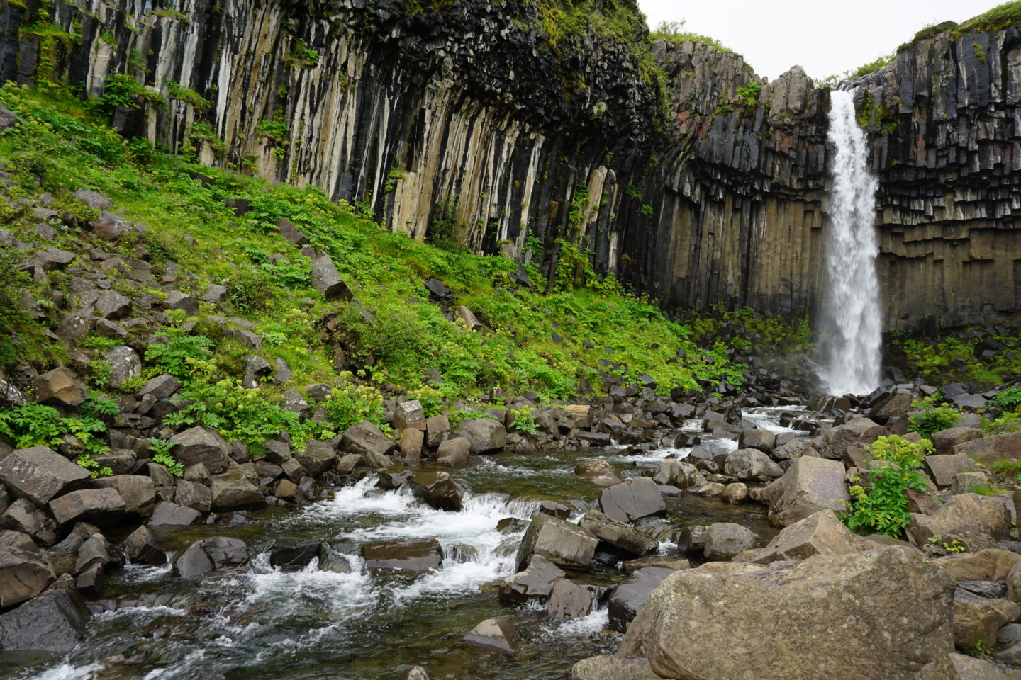
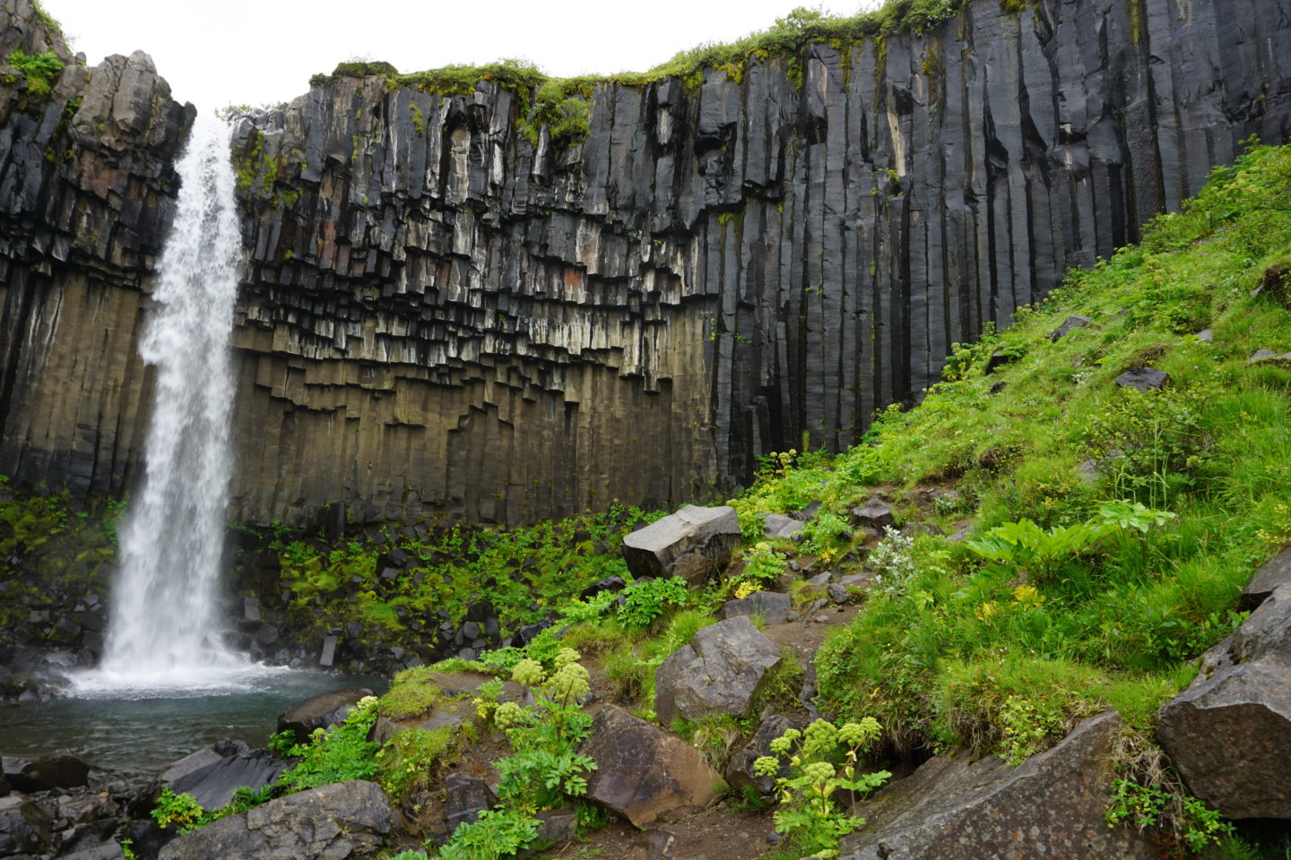
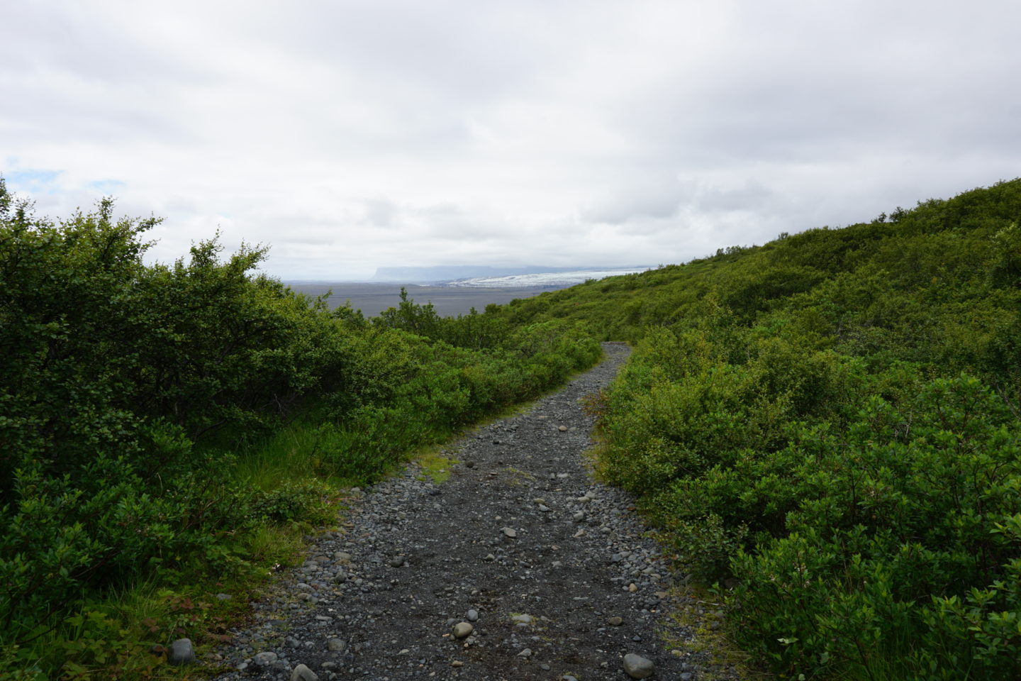
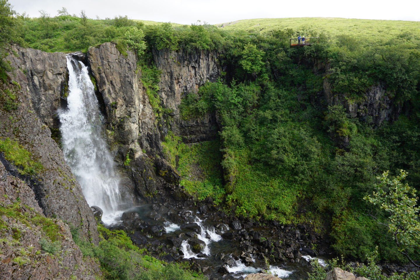
Next, I drove up the east coast to Vatnajökull National Park, home of Europe’s largest glacier and the Svartifoss waterfall. My knee was giving me a bit of trouble so I decided not to do a huge hike into the glacier. Instead I hiked in to the waterfall and then out a slightly different way so that I could see Sel, a turf farm maintained by the National Museum of Iceland starting in 1972 after it was abandoned in 1946. Svartifoss was so beautiful! I loved the starkness of the black columnar basalt against the waterfall; it really seemed like a cathedral of sorts.
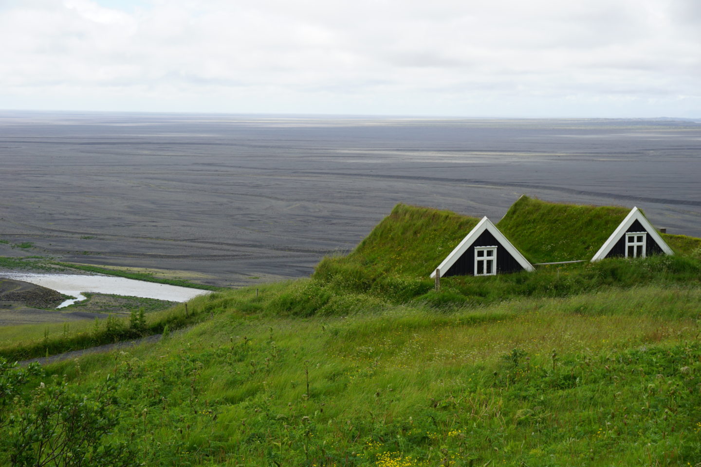
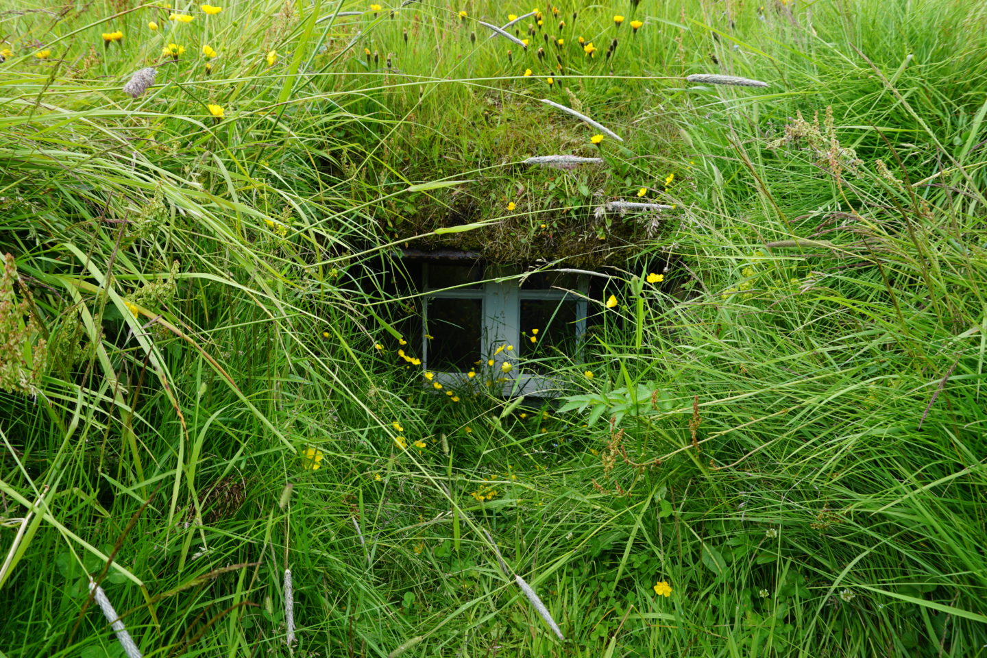
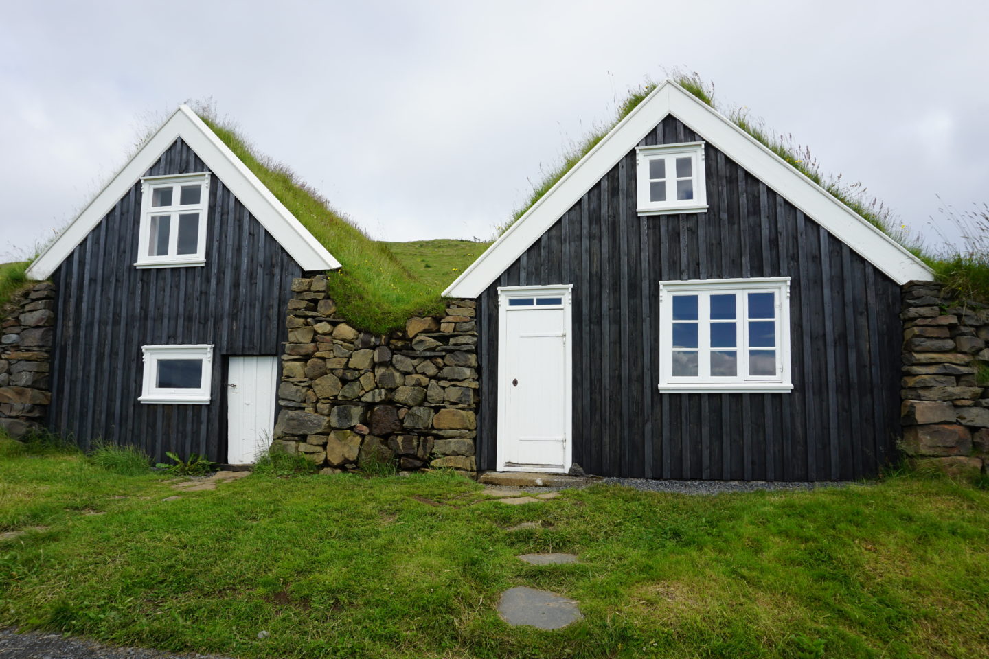
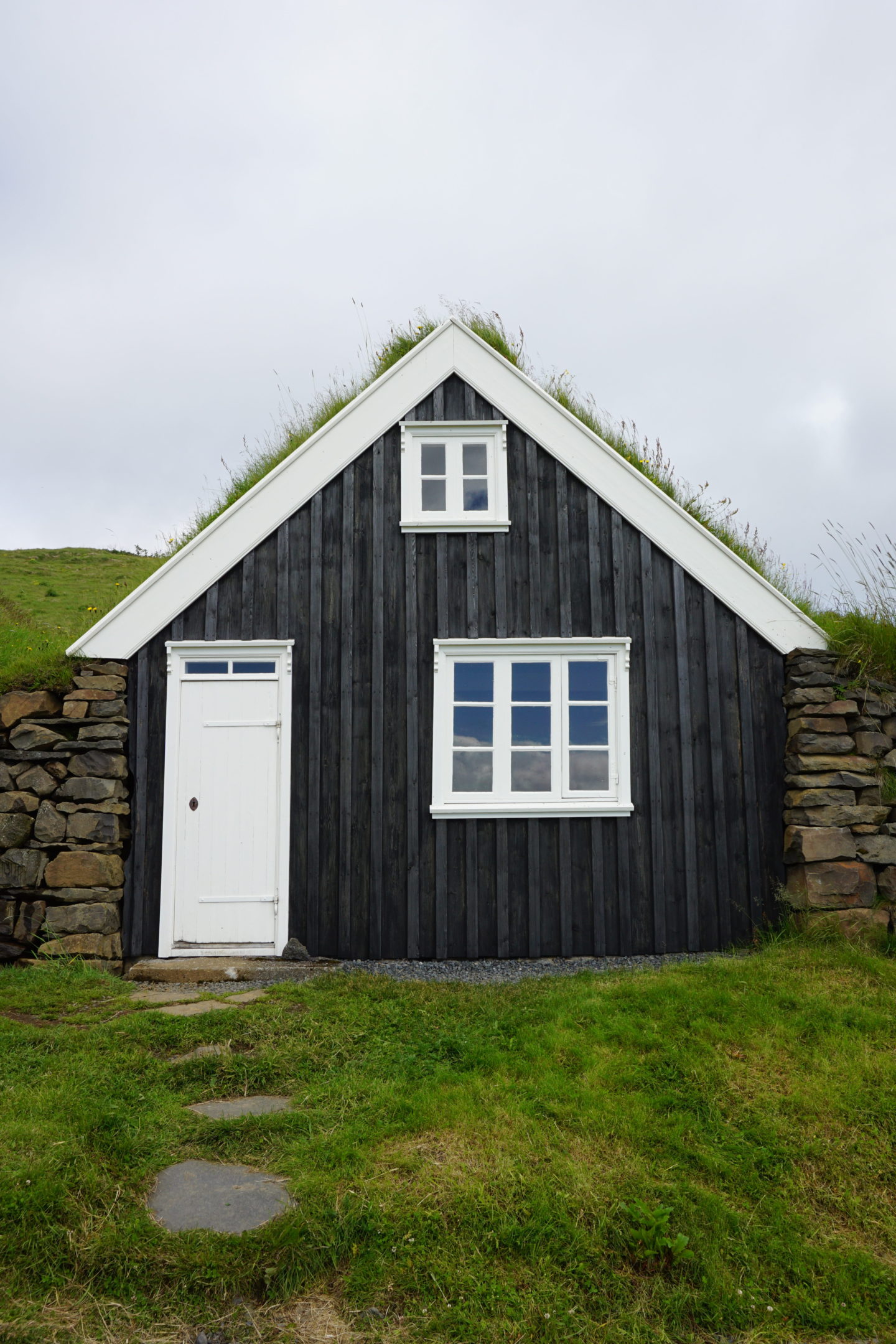
I have to say that I love houses with grass roofs. Especially the ones like this where they’re basically embedded in a hill so that part of the house is in the ground. It might seem like a joke, but this is kind of my dream house, haha. Especially you could look in the windows and there were two beds made up on the upper floor of one of them. They’re interconnected – the bottom floor of one of them was an animal stable and then you could go up stairs inside the other one in order to get to the floor above the animals, where they had bedrooms in order to take advantage of the heat produced by the animals below in the winter. I also took a photo of the view from the front step of the house in order to fully sell you all on why I need to live there.
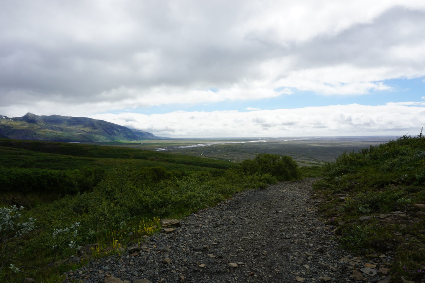
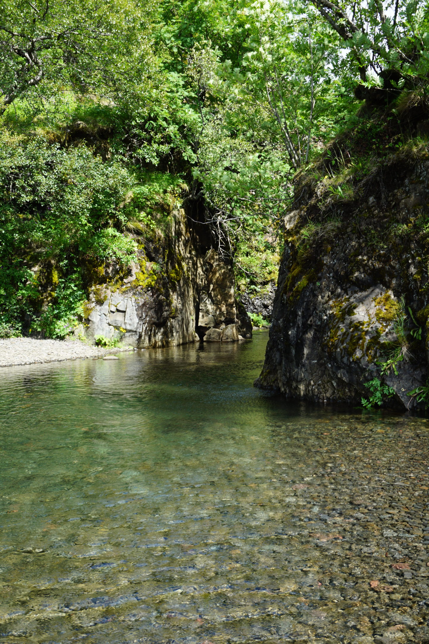
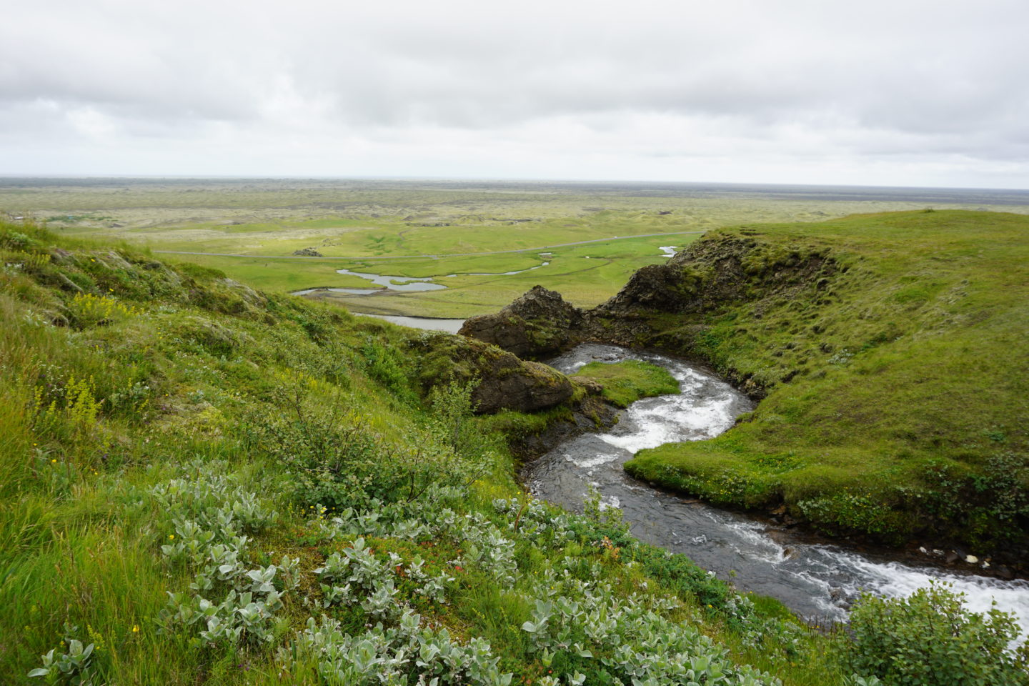
After resting there for a bit, I hiked back to the visitors centre and took a few photos along the way. There was a little river at the very bottom, and I was so intrigued to see what was in that cozy looking place past the two rocks below. I can’t say for sure, but I’m assuming there’s a troll family living in a cute little house on the side of the peaceful river, just out of reach of tourists.
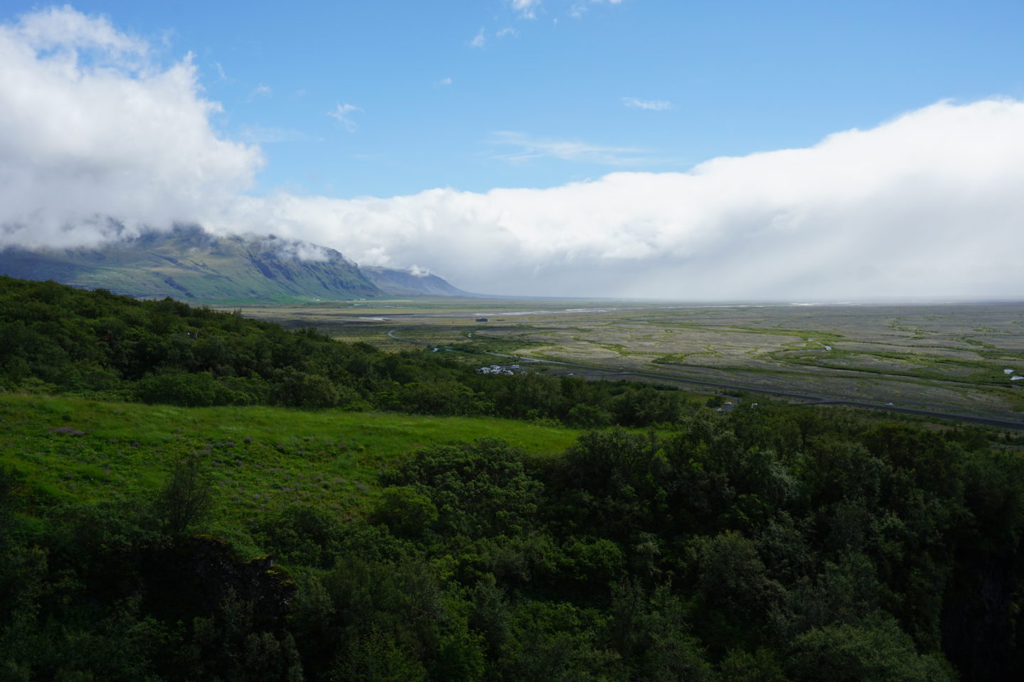
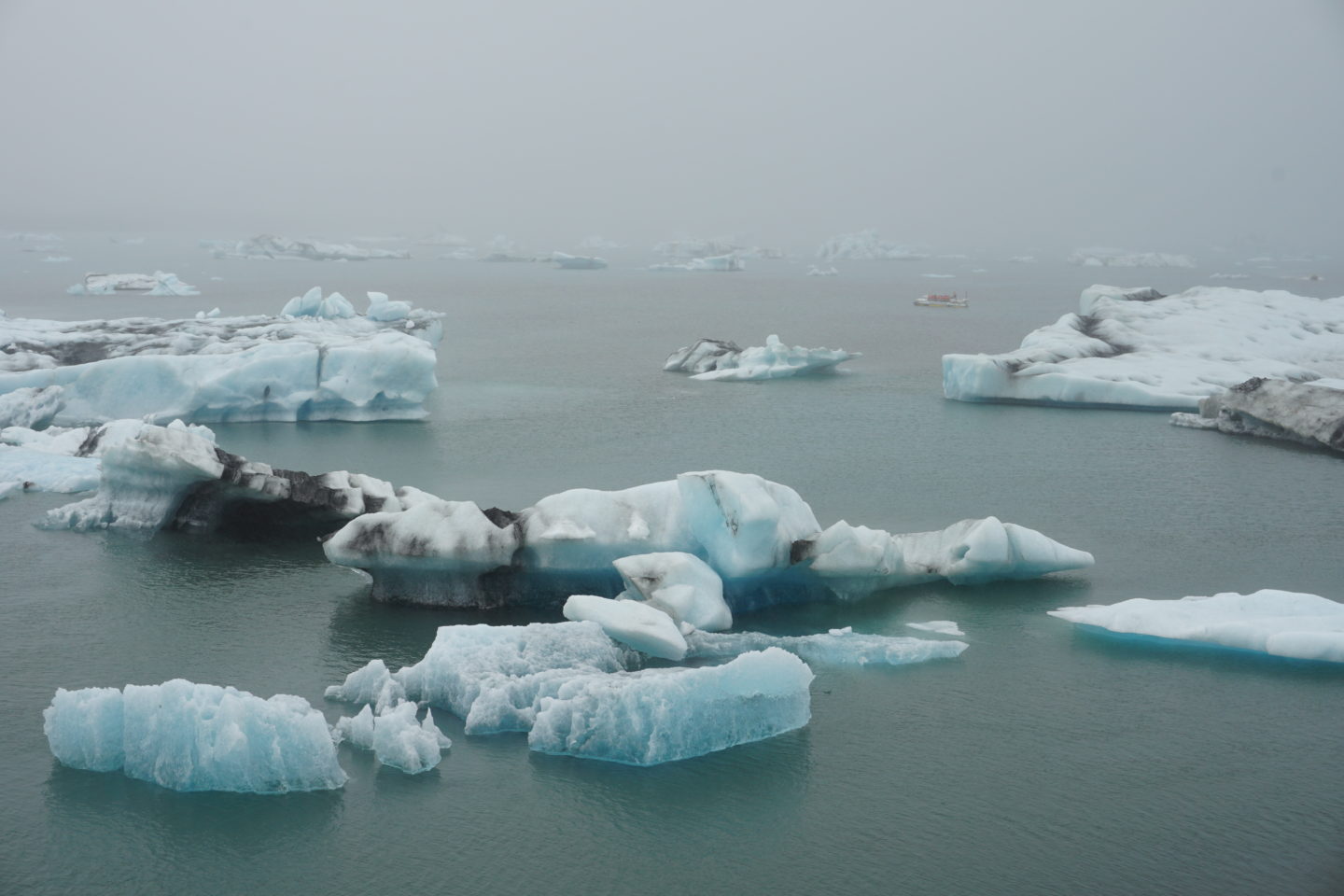
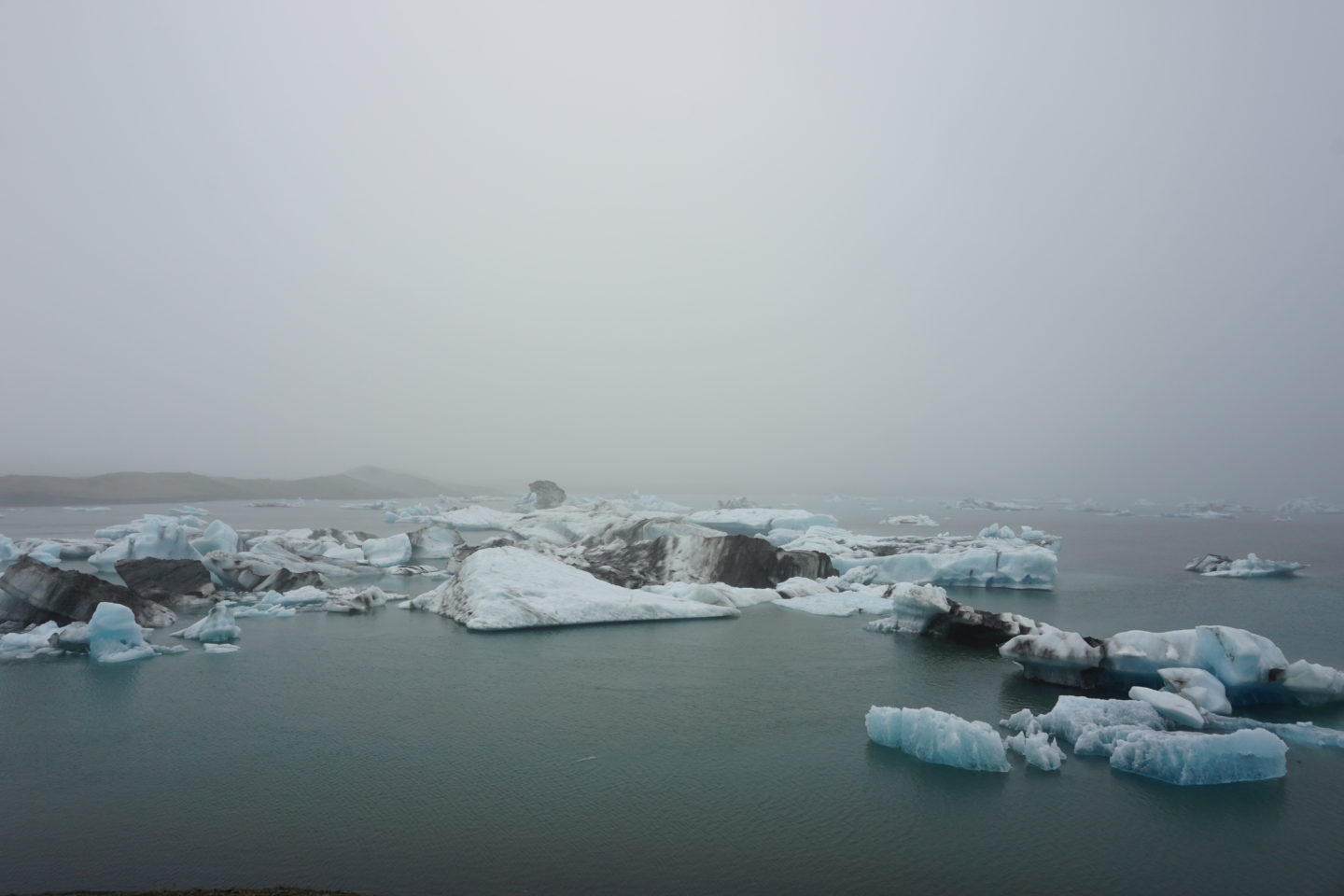
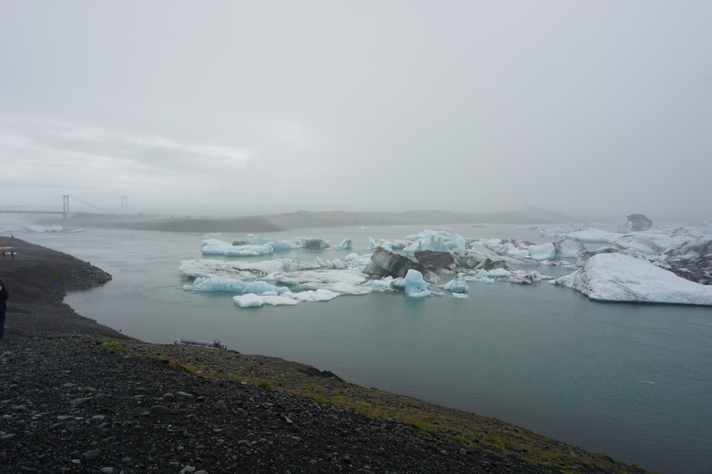
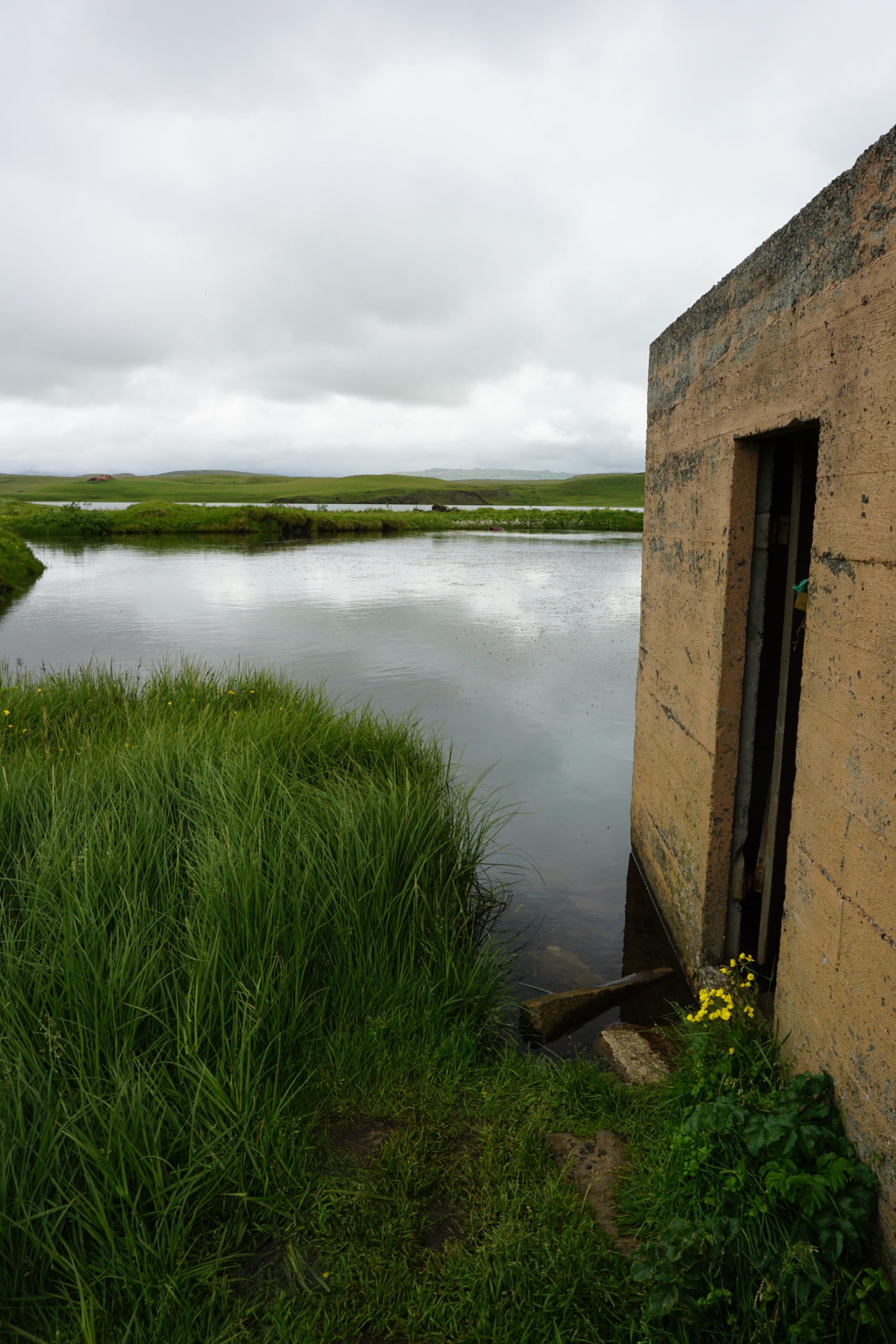
I drove further up the coast after that to Glacier Lagoon. A lot of people do boat tours of the lagoon, but it’s kind of expensive and I didn’t really feel that I needed to do it in order to get a sense of the area. Plus, it takes a good 2+ hours (I think) and I didn’t want to take up that much time. It was very foggy and spooky when I was there, which made everything more eerie. It also made problems when I tried to leave and head back down the coast, because Iceland has a lot of single-lane bridges on the highway. There’s one that’s on the longer side right by the lagoon, and it was so foggy that the car in front of me started across the bridge and then realized a little bit into it that there was already a car coming from the other side that the fog had obscured, so we had to reverse back across the bridge and down the road so the oncoming car had room to get off the bridge!
Further south, close to where I’d started in the morning, I stopped at Kirkugólf, which means “church floor” (although there’s never been any evidence of there having been a church in the location in question). The “floor” is made up of the top of basalt columns, which form perpendicular to the cooling surface. When they cool and harden, they split apart from each other forming these columns. The cross-section of this kind of looks like a beehive to me!
Finally, I thought I’d do a quick stop at Systrafoss, a waterfall very close to Kirkugólf. The waterfall was honestly really hard to photograph. It was really impressive and tall in person, but I couldn’t get a good photo. There was a trail that continued up the side, and silly me, I was like, the waterfall isn’t that tall, I’ll go up and see because I’m already here. Well. It was just stairs and stairs and stairs all the way up the hill, and by the time I realized how long it was I felt I’d committed too much time and effort not to continue all the way to the top. But I’m glad I did! The top was very flat and there was actually a lake up there, and you could walk around and see exactly where the water went over the cliff into the falls. Plus the view was great!
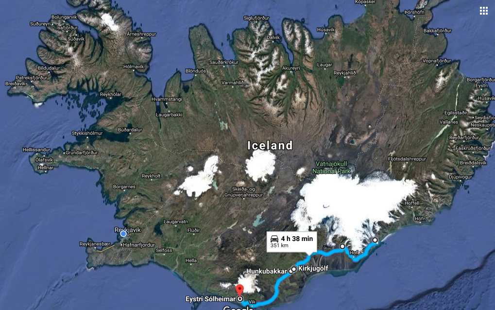
 I stayed at a guesthouse on a working farm last night, which had really bad reception just in that one spot (hence why this blog post is being posted the next morning!). Today I’m headed out to see black sand, a hot spring, and of course more waterfalls. I’ll be back in Reykjavik tonight – hoping I can fit in Geysir and Thingvellir today or tomorrow before I leave (so sad!). Below is the map of where I went!